Mt. Evans – A Road Review

Mt. Evans – A Road Review

I’ve written race reviews. I’ve written ride reviews. I’ve written some equipment reviews. Now, I respectfully submit my first ever “road review”.  I recently had the opportunity to ride my bike up the highest paved road in North America. This wasn’t the first time I’ve made the ascent; I’ve done the climb a handful of times. Once when the road was closed to traffic because of a bike race, and the others when the road was open to motorized vehicles.

What made this ascent special was that the road was closed to vehicles because of the Coronavirus. If you’re a person who will only experience North America’s highest paved road from car windows, then this is yet another thing to add to the list of what’s been taken away by the pandemic of 2020.

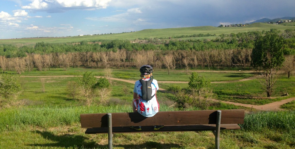
Let’s begin with a little history lesson. First, Mt. Evans is the most prominent peak visible to the west of Denver.Denver_at_a_Glance___VISIT_DENVER 
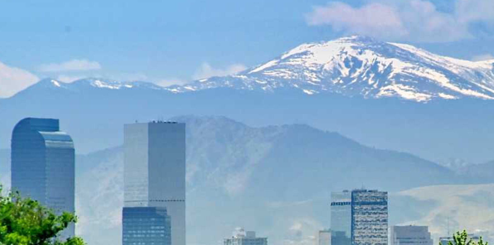
It is one of Colorado’s iconic 14ers. 14ers are peaks whose summits are at or above 14,000 feet above sea level. Colorado is home to 53 such peaks. Construction on Colorado Highway 5 began back in July of 1923. After about eight years of construction, the road opened to the public. The road is about 14 miles long and begins at an elevation of 10,600 feet at Echo Lake.  It winds through the Arapahoe National forest with trees 900 – 2,000 years old. Beautiful scenery of alpine lakes, the continental divide, wild flowers and wild life abound. 

Enough about the spectacular scenery, let’s get to the road conditions.  As the highest paved road in North America, there are some challenges that go along with maintaining the road.  Winters are long and harsh and take a toll on the road.  Let’s face it, at that elevation, most cyclists are pedaling along slowly enough to easily avoid the larger holes and cracks on the ascent.  And there are many cracks in the road, particularly from mile 9 to the summit.  There are also some wheel eating sized holes along the way.  

However, on the descent, these bumps, cracks, and holes present a danger to cyclists.  I’ve witnessed bike crashes resulting in broken bones on the descent.  The best advice I’ve received for the descent is to let some air out of the tires.  The next best thing to happen is not to have to contend with vehicles on the descent.  Without cars, cyclists can really take advantage of finding the smoothest line for the descent.  In many instances, this is right down the middle of the narrow road.

Perhaps the most exciting side effect of closing the road to motorized vehicles was the abundance of mountain goats and big horn sheep at the summit.  There were so many standing on the road, laying beside the road, playing just off the road. I wish that everyone could witness that, but I suspect the cars have a tendency to drive them further away.

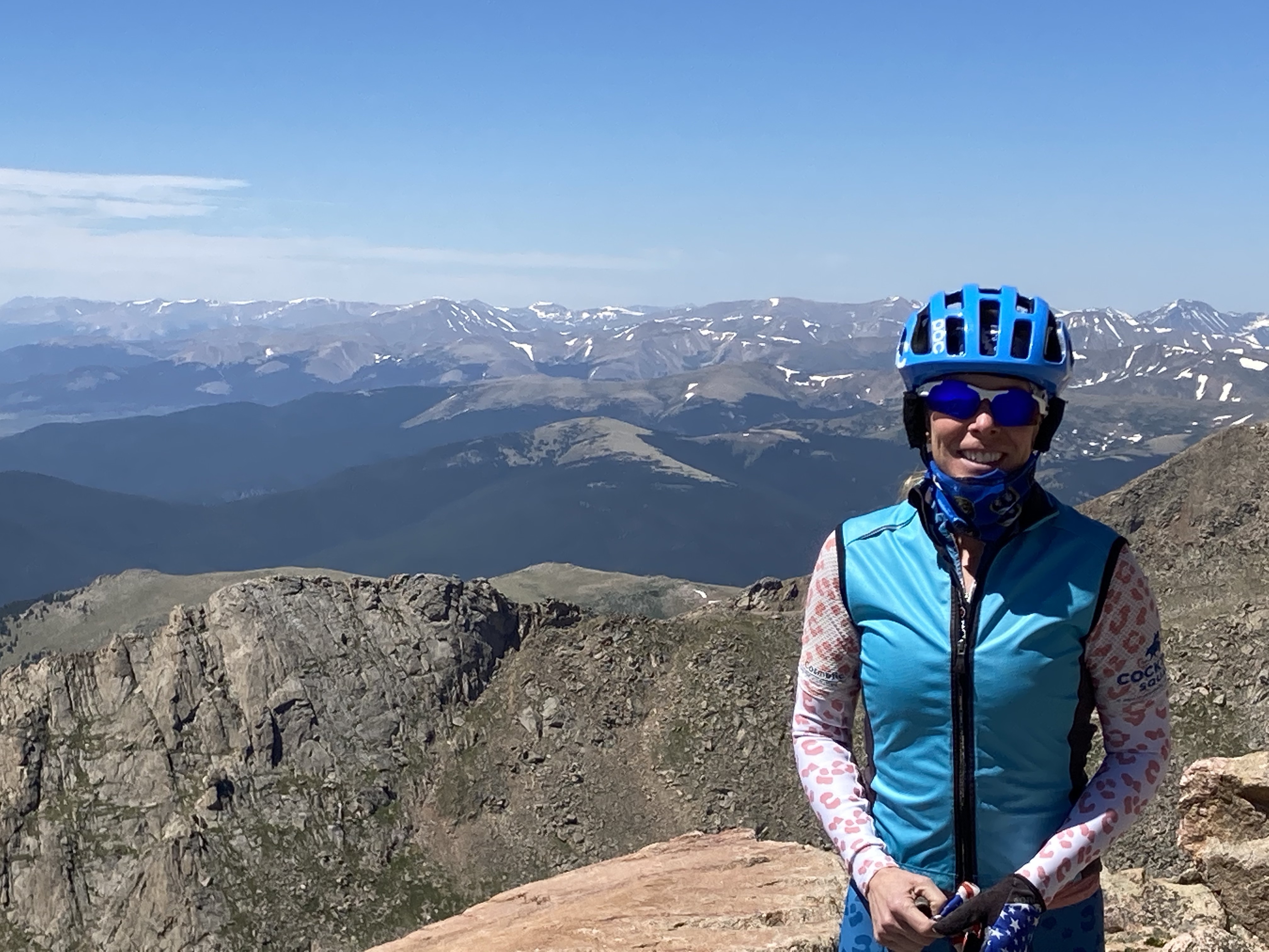
It may be selfish, but I’m voting to keep the road closed to vehicles indefinitely.  Having the mountain to yourself on the bike was such a treat!  I saw all forms of bikes being ridden by riders of all ages.  One fine gentleman that I spoke with was on his second ascent of the day, and he was probably 20 years my senior.  I saw two kid trailers being pulled along by brave (and strong) parents.  What a memorable family outing that would be!

gCdxhpt+TpClequ0Jk4CDA

To the West of Mt. Evans

fullsizeoutput_528e

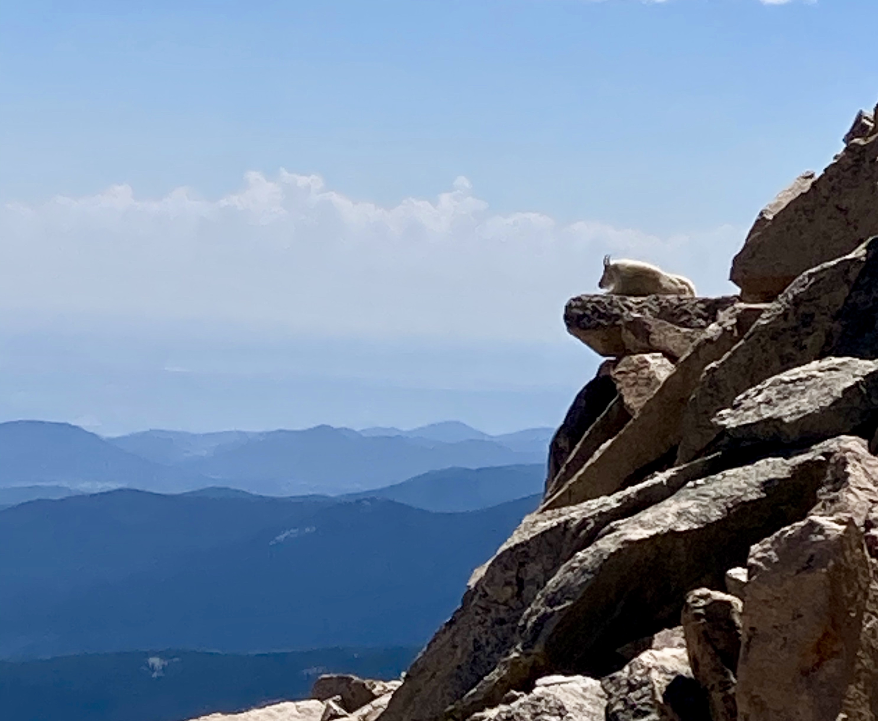
The Mountain Goat King

fullsizeoutput_529f

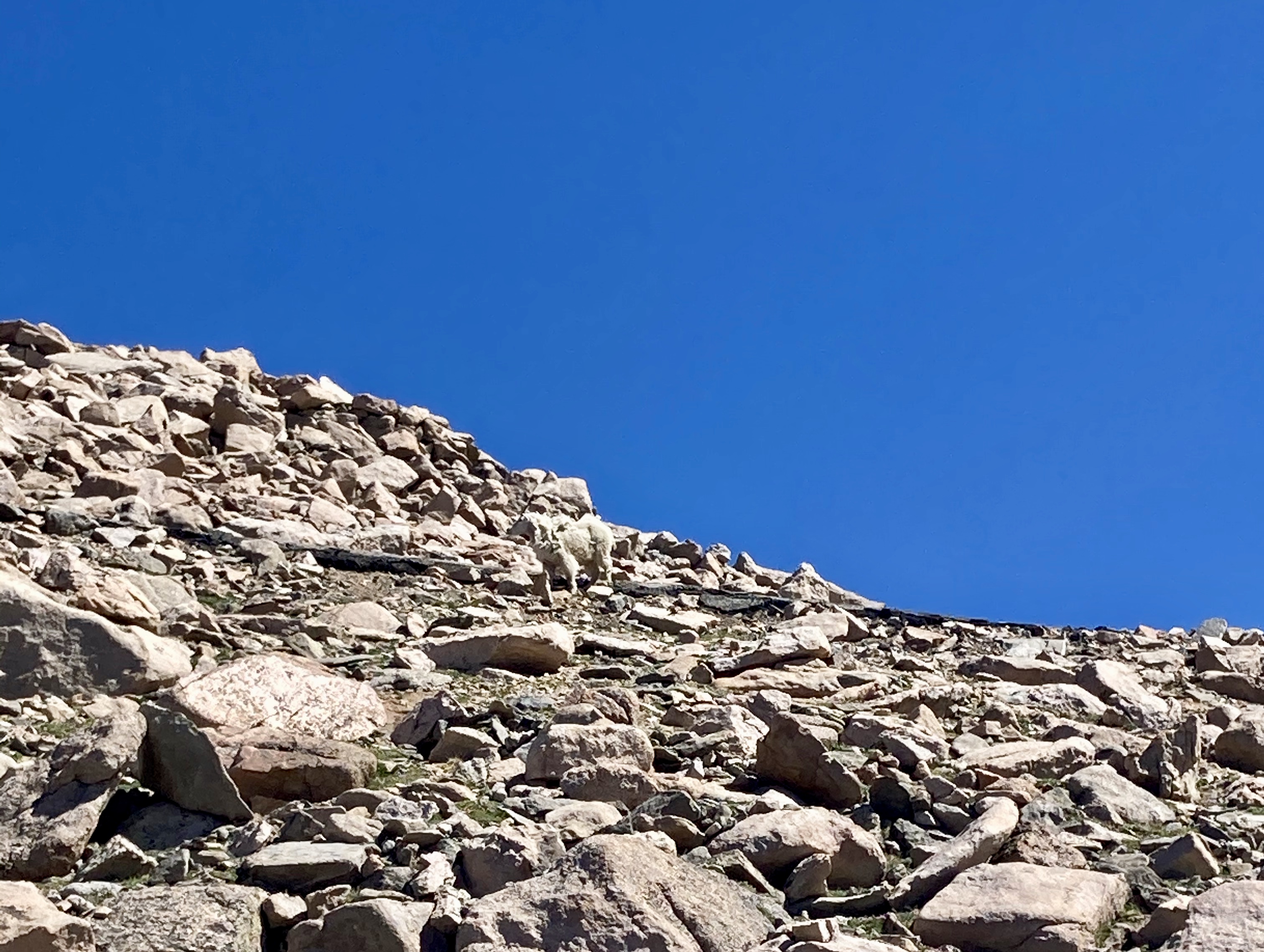
Can you see him?  And yes, the sky is really that blue in Colorado.

Advertisement

Yellowstone Cycle Tour – A Ride Review

Yellowstone Park.  You’ve probably heard of it.  Established on March 1, 1872, it was the first national park in the United States.  Some consider it the first national park in the world.  It truly is an international tourist destination.  This is evidenced by the droves of tourists arriving by the car and busload throughout the park.  For this reason, I’ve been hesitant to travel through the park by bicycle.  Sharing a road with a designated bike lane doesn’t get a second thought from me.  But sharing a narrow road with someone who may not know the park rules, local laws, nor speak the language or be able to read the signs AND being distracted by the geothermal features and wildlife is another.  Quite frankly, it wasn’t a risk I was willing to take, no matter how beautiful the scenery.

When I heard that there was an organized ride through the park in the fall, a little spark of hope was lit.  Riding a bike in my favorite season, through one of my favorite places, with support and lots of signage alerting drivers of the cyclists was just what I needed!

I did some online research and discovered the website www.cycleyellowstone.com.  Registration for the 2016 Yellowstone Cycle Tour would open on June 15, 2016 and close when sold out.  The ride was limited to 300 riders.  I marked my calendar and began to consider who I would ask to ride with me.  The drive to West Yellowstone would be a very long day in the car from Denver, and perhaps best suited for two days.  The ride from

img_5655

Kimberly is the only woman who could pair cycling clothes with cowboy boots and make it look good!

West Yellowstone to Old Faithful was 62 miles round trip.  In October, it could be snowing there.  Of all my family members and friends, Kimberly was the one person who just might be crazy enough to sign up for this adventure with me… and she did.

We arrived in beautiful West Yellowstone, Montana on the eve of October 7th.  Kimberly is a local in Bozeman and was able to score us a very nice room at the Bar N Ranch just outside of West Yellowstone.  We had an excellent dinner in the dining hall at the ranch and got up early Saturday morning for breakfast before our departure.  The ride was organized to depart in two waves.  The first wave was for what the ride organizers referred to as “more experienced riders” and the second wave was for the less experienced.  We departed somewhere in the middle between the two waves.  We settled into a slight prolonged climb for the next fifteen miles.  The buffalo and elk wasted no time and made their appearance very quickly into our ride.

img_5684

Lots of this type of signage was placed along the ride route.

The only aid station was located fifteen miles into the ride at Madison Junction.  We stopped for a bathroom break and visited the very well stocked aid station.  Ride organizers had provided an assortment of fresh fruits, candies, packaged bars, and liquids for riders.  The departure from Madison Junction was directly into a prolonged climb that leveled out on the top of a plateau about 500 vertical feet later at 7200 feet .  It was along this plateau about 7 miles from Old Faithful where the highlight of the trip occurred.  Kimberly and I were just riding along when we realized how quiet it had become because there was not another cyclist or car nearby.  The only thing nearby were the 20-30 buffalo bedded down maybe 30 feet from the road. This was the closest that I’d ever been to the giants and it was quite magnificent to see.  I very much wanted to stop for a picture, but did not want to stop for any wildlife near the road without having a car between us.

When we arrived at Old Faithful, the first order of business was to find the lunch tent.  The second order of business was to see whether Old Faithful was erupting or how long we might have to wait until the next predicted eruption.  We had about 45 minutes to wait and despite the fact that we’d both seen the eruption before, decided that it was worth the wait after pedaling for 30 miles.  We sat down to enjoy the lunch that was an option at registration.  Mine consisted of a very tasty PB&J, chips, an apple, and a cookie.  There were also other munchies available for riders at the tour tent.

After watching Old Faithful do its magic, we hopped back on the bikes.  Kimberly was vocal img_5681
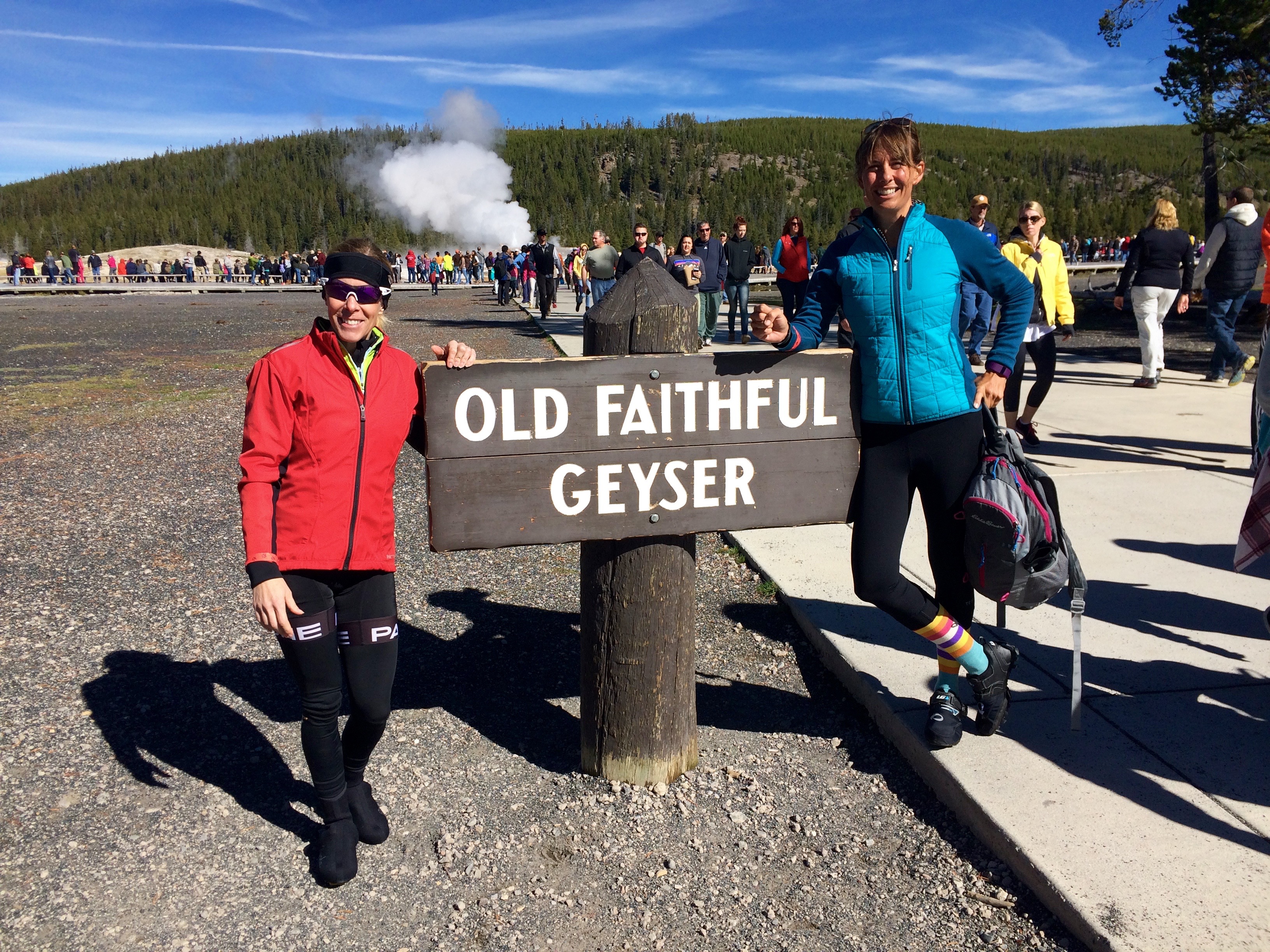
about her tushy not being very excited about being back in the saddle.  If she had wanted to catch the SAG wagon, she could have because they were plentiful.  But like all the Minkoff’s, she didn’t give up.   Eventually, we came back to the feed station at Madison Junction and stopped for sweets and coffee.  Much to our surprise, we found ourselves removing clothing because the weather was so warm.

On the drive back to Bozeman, we decided that despite our aches and pains, we had a fantastic time.  So much so that there is likely to be another cousins adventure next year.  Stay tuned!!

PS – Off road biking in Yellowstone is limited to very few (read: short) opportunities.  Check their website for details. Spots in the Yellowstone Cycle tour are limited and go fast.  We were essentially begged to ride single file to ensure that the event would be a go the following year.  If you are the kind of cyclist who is incapable of riding single file, don’t register for this event.  Don’t be the person who spoils this wonderful opportunity for others.  Just don’t.


img_5665

This is the Midway Basin Geyser area.  Yep, that’s a snow pole and it’s taller than me!

img_5683

Yep, those are buffalos laying in the meadow.  They were far enough away that I was willing to stop for a picture. (Madison Junction area)


The Emergency Commute

I frequently commute via bike to my job…it’s only a 3 mile trip, so there isn’t really a good excuse not to ride to work!  Because North Table Mesa sits between my house and work destination, sometimes I’ll take the dirt around the base of the mesa.  When I opt for this route, I usually select either my mountain or cyclocross bike.  Most days, however, I ride my road bike in the hopes that I’ll have the opportunity to tack on some additional mileage to my commute.  I’ve written in other blog posts about how I like to be prepared for the unexpected when I ride.  However, I found myself dreadfully unprepared last week when my phone rang and my husband informed me that he was on his way to the Emergency Room at St. Anthony’s Hospital.

a + cMaybe I should clarify… I was prepared to fix a flat tire, or to use the multi-tool I keep in the pouch under my saddle to adjust something, or to ride for 40 miles if the opportunity presented itself.  I was not prepared to go to an ER.  Where would I put my bike, especially since I didn’t have a lock with me?  Would it take longer to ride there than to pedal home, get the car, and turn around and drive right past where I was sitting to get to the hospital?  The biggest question of all was whether Motoman was experiencing a blood clot in his lungs and if so, could I get there in time?  My mind was racing with questions.

I quickly used google maps to find a bicycling route from where I was to the hospital where Motoman was going.  Fortunately for me, I had chosen to ride the road bike on this day.  I knew my way through Golden by bike just fine, but riding through Lakewood was completely new to me.  I got a general idea of the way I wanted to go and good ole Google was showing it would take me an hour to ride there.  I was confident that on this occasion, Google was wrong.  I stuffed my crocs in my backpack so I’d have something besides cycling shoes to wear when I arrived at the ER, strapped on my shoes and helmet, and pedaled away.

I arrived at St. Anthony’s ER 42 minutes later.  Security was kind enough to watch over my bike for the few minutes it took to track down Motoman and get the key to the car he’d driven to the ER.  I’m sure they would have held onto the bike indefinitely, but I’ve never trusted complete strangers with any of my babies.  I locked the bike in the car and spent the next couple of hours with Motoman.  He was later discharged with a diagnosis of Atelectasis – a complication of the surgery he’d had two days before.

Since that day, I’ve toyed with the idea of carrying with me a locking cable no matter what kind of ride I’m taking – leisure or commute.  But the reality is that I’m not sure I want to be prepared for a trip to the ER.  So for now, the lock will stay in the garage until my next commute to the grocery store.