It’s a Sign!

It’s a Sign!

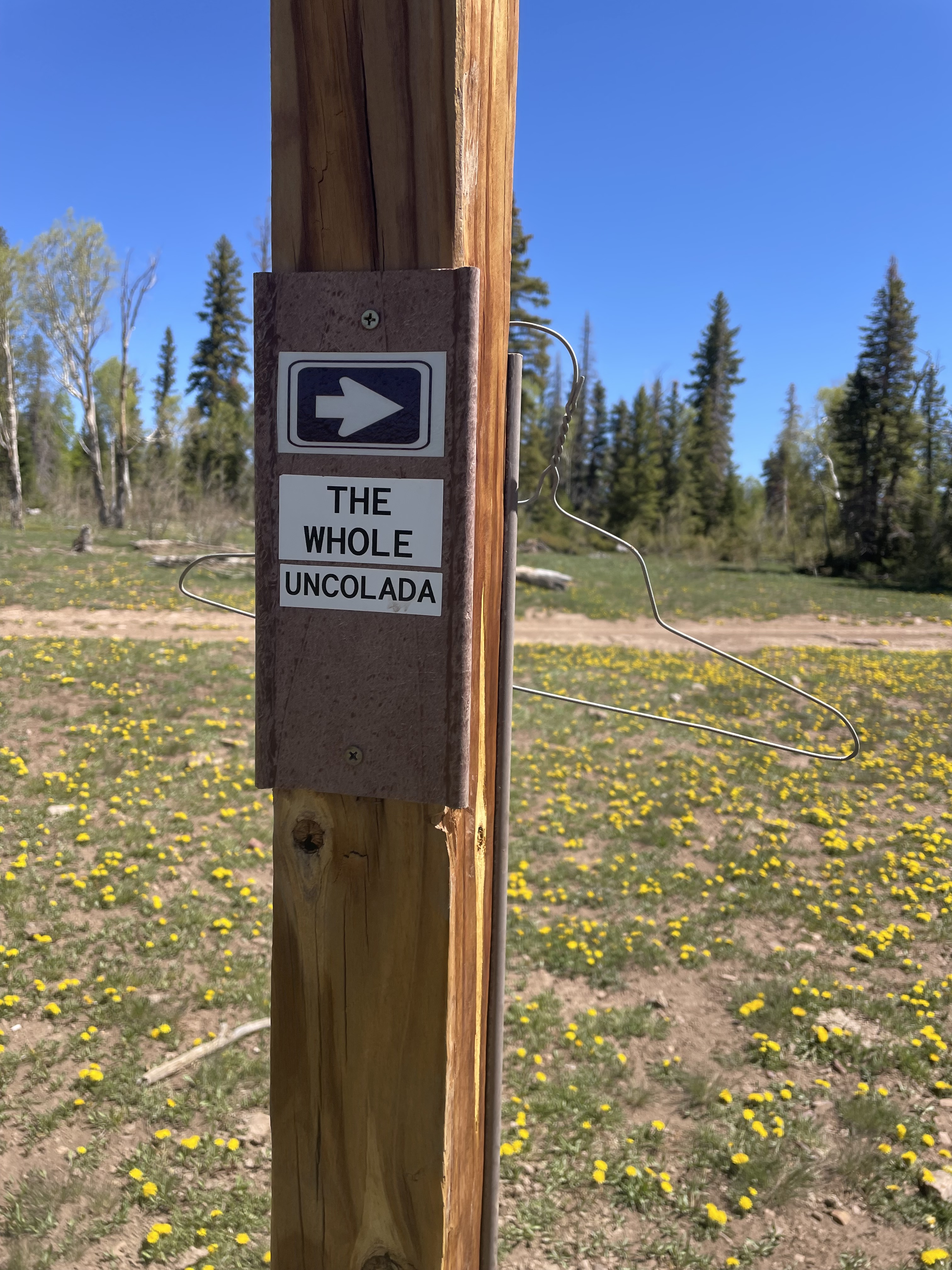
Signs, signs, everywhere there’s signs, or so the song goes. I’ve encountered a variety of signs over the years as I’ve been riding. Some are funny, some are serious, and some are more memorable than others. Here’s a fun one from the Black Bear trail:

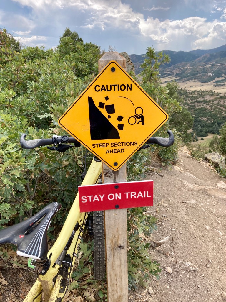
Needless to say, I did stay on the trail.

Where I live in northwest Arvada, there is a canal system that includes two canals running parallel to one another (Farmer’s High Line Canal and Croke Canal). The canals are paralleled by a dirt access road. When I was a runner, I often ran along a certain section of the canal with my dog, Loki. Eventually I stopped running, started biking instead, moved and didn’t return to that section of canal for several years.

Then there was a pandemic. I began to look for new, car free places to ride my bike and eventually came upon a route that included this section of canal where I had run with Loki so many years ago.

The route actually follows the canal roads, until the gates prevent access. Normally, I just ride around on the public streets as a workaround, but I found myself with a little extra time on my hands the last time I rode this route. I decided to give the phone number listed on the sign a call. Sure enough, it’s a legitimate number for Farmers Reservoir & Irrigation Company. They’re located over in Brighton, Colorado. The receptionist who answered my call transferred me to a gentleman I will call John*.


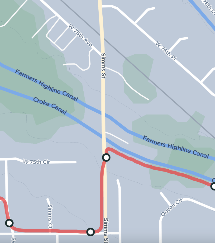
Initially, John had no idea where the gates were or why they would be present. As we talked, he was looking on a map trying to pinpoint my exact location, which was on the west side of Sims Street, south of the railroad tracks at 76th Street, right at the Croke Canal road. I emailed him the same picture above and here’s the response I received “I just spoke to my Leadman who handles the Croke Canal. This is FRICO’s gate. Not sure why it is there. If you want to continue riding your bike, I think you can easily go around the gate. There probably isn’t anymore gates past this one.” My conclusion with this response was that I could bypass the gate and carryon along the canal road.

As it turns out, there are more gates. But this gate and the next gate to the west are the only gates that include the No Tresspassing sign. I responded to John with a picture of the next gate, pointing out the barbed wire that adds emphasis to the threat. I just wanted to understand why there was unobstructed access to the canal for miles before this section, and then suddenly the gates. His response to my follow up email was much less friendly. Here it is in part “These gates are ours. They are to restrict access from pedestrians and vehicles as it is private property. These roads are used to maintain our canals. Like I said yesterday, technically you are trespassing by riding your bike on our access roads.  They are not for public use”.

So there it is! I can’t help but think of the rest of the song lyrics: do this, don’t do that, can’t you read the sign?? Having unencumbered access to this canal road is such a missed opportunity for the citizens of west Arvada. In a city with so many two lane roads that do not have bike paths or sidewalks, this is a safe, traffic free alternative for walkers and bikers alike. The Farmer’s Highline Canal offers 71 miles of park space throughout the Denver metropolitan area. It’s a shame that the City of Arvada hasn’t partnered with Farmers Reservoir & Irrigation Company to make a similar trail system available to its residents.

Notes:
* John is not John’s real name.

Loki somehow managed to be all head in this picture from his running days. He was a good friend.

Advertisement

The Truth About E-bike Trail Access

When I met Motoman 25 years ago, I quickly learned that he was an adventurer. Our weekends consisted of rock climbing, mountain biking, and jet skiing, among other activities. At one point I joked that I needed to return to work on Mondays so that my body could sit at a desk and recover from the adventures of the weekend. Fast forward to today, and he still loves a good adventure, but the activities involved in the adventures look a little different. Over that span of 25 years, there have been injuries, crashes, not to mention the under appreciated impacts of aging in general – all of which have impacted mobility.

During the pandemic, Motoman purchased a class 1 e-bike as a way to spend a little more time with me, a little more time outdoors, and for a different form of exercise. I’m not writing this post to educate the world on the classes of e-bikes, but I will say that the class 1 is the only e-bike that REQUIRES pedaling to move forward. What we weren’t aware of when he purchased the bike, was the magnitude of controversy surrounding the different classes of e-bikes and where they are allowed and not allowed. This is an entirely different conversation from the riders who are simply anti-e-bike. But speaking of anti-e-bikers, we’ve certainly encountered plenty of those people on the trails. Imagine taking your new e-bike out for its maiden voyage and having a complete stranger call you names like “cheater”, or worse.

Nowadays on our mountain biking adventures, he follows me. I set the pace for our little peloton of two on my old Juliana – the kind without a battery operated motor. We do this because one of the objectives of purchasing the e-bike was to spend more time together. My pace is the limiting factor between the two bikes, so I lead the way. Occasionally, he’ll pass on a particularly steep or technical section of trail, but then he waits for me to retake the lead. I share this because I think it’s important to know that not all e-bikers are out on the trail to go faster than everyone else.

We learned very quickly that it’s difficult to know where e-bikes are allowed and not allowed to be ridden. Websites* that we have used for trail discovery and research are not always up to date with the latest information. Case in point: the 18 Road Trail System in Fruita, Colorado. As of the time of writing this article, those websites* indicate that e-bikes are not allowed. The BLM website for this trail system does not mention e-bikes. Yet, I took this image onsite at 18 Road during my trip in June of 2022. Clearly, Class 1 e-bikes are allowed as of April 8, 2022.

In other instances, our ride research has led us to a trail head, only to find that the signage at the trail head prohibits e-bikes. This is particularly frustrating when you’ve driven miles to the trail head. I have wondered at times if the trail head signage hasn’t been manipulated by trail users who are anti e-bike. I have encountered signage manipulation against motorcycles in the past, so it wouldn’t come as a complete surprise to see such behavior directed at e-bikes.

As a result of this mixed information, some folks are opting to ride their class 1 e-bikes on trails where they are prohibited, stating that they’ll take their chances on getting caught. We tend to ride in places that we know without a doubt allow e-bikes. We also make a conscious decision against spending our dollars in municipalities and counties that ban class 1 e-bikes on their local trails. Does this little boycott have any impact on anything? Absolutely not. But it does make us feel slightly better about being banned.

The categorization of Class 1 e-bikes as a “motorized vehicle” seems to be the root of the problem. Some places prohibit all motorized vehicles, and I understand what they were getting at when the rule was made. Bike manufactures, or whoever the gods were that decided to call e-bikes “motorized vehicles”, really did a dis-service to users of class 1 e-bikes. These are truly pedal assist bikes that open up cycling opportunity to people with mobility limitations. I’m no lawyer nor do I play one on TV, but I suspect at some point there will be a legal challenge that the “no motorized vehicles” rule discriminates against people who use class 1 e-bikes as a means of adaptation to a disability.

Vehicles have evolved since those rules were created. I know our government can be slow to adapt, but maybe it’s time now for their rules to evolve so they can be appropriately applied to newer technologies that didn’t exist when the rules were written. Let’s be realistic, e-bikes aren’t going anywhere… except maybe faster than you!

* Websites that serve as a database of biking trails with reviews, ratings, commentary, and downloadable gpx files shall not be named in this article.

Colorado Mountain Bike Sampler

Colorado Mountain Bike Sampler

Colorado has so much to offer in terms of mountain biking. I recently made a tour of several places that I’d been wanting to ride. It was the ultimate Colorado mountain biking sampler.

Hardscrabble map at the trail head

Day 1: East Hardscrabble Trail System – Eagle, Colorado – Located just off I-70, the East Harscrabble Trail System is a “SRMA”, Special Recreational Management Area of BLM Public Land. I found a loop on MTBProject.com that I had planned to ride. Unfortunately, the description lead me to a different trail head so I ended up doing an out and back. My advise is to thoroughly research your ride to ensure this does not happen to you. The trail I rode up was clearly designed for downhill, so I ended up scrambling out of the way on a couple of occasions. What I didn’t realize at the time is there is also a West Hardscrabble trail System that is open to ATV’s and motorcycles. I spent just over an hour riding here but it was long enough to know that I’d like to go back for more. Next stop: the desert.

Day 1: 18 Road Trail System – Fruita, Colorado – Located just a few miles north of Fruita, Colorado. This location is also BLM Public Land. I arrived in the early evening. What’s great about riding at this trail system in addition to its proximity to Fruita, is there is also camping available, and well maintained vault toilets. While the trail system is located in the desert, it doesn’t have the technical rocks and ledges that tend to be present in the desert. In fact, the trails I rode were so dry and well traveled, it was almost like riding on a concrete path in places. Because this system is nestled right up against what is known as the “book cliffs”, some of the trails offer a lot of short and snappy ups and downs, so speed is key. I was able to get one ride in just before sunset on Day 1 and an early morning ride on Day 2. Trees in the area are scarce, so my suggestion is to choose a campsite wisely and avoid riding in the heat of the day. As of April 8, 2022, Class 1 E-Bikes are welcome to ride throughout the 18 Road Trail System.

A view from Mary’s Loop

Day 2: Kokopelli Loops at McInnis Canyon Conservation Area – Loma, Colorado – Located just west of Fruita, right along the Colorado/Utah border sits the McInnis Canyon Conservation Area. Trailhead parking is right off I-70, giving this trail system quick and easy access. I spent most of Day 2 riding the variety of trails available in this system: from easy green loops (Rustler’s Loop), to a very difficult black diamond trail (Moore Fun). This trail system is full of sandy, ledgy, rocky technical features. The scenery in this area is breathtaking. Trees are scarce and riding in the middle of the day in the desert is not ideal, but it’s what worked with my schedule that day.

50 Shades of Green

Day 3: Uncompahgre National Forest – Montrose, Colorado – Montrose is the gateway to the San Juan Mountains. However, just west of town is a lesser known gem for mountain biking, the Uncompahgre Plateau. If you’re a mountain biker, you’ve probably heard of a ride near Moab called “the whole enchilada”. Not to be outdone, Montrose offers “the whole uncolada”. I rode a portion of this trail and found it to be a pleasant change from the desert riding of the previous two days. The route went through the forest and it was considerably cooler on the Plateau. In my Strava upload, I ended up calling the ride 50 Shades of Green, and you can probably guess why.

Day 4: Electric Hills Trail System– Montrose, Colorado – What happens when land provided by Xcel Energy is developed into a mountain bike trail system? You end up with fantastic trail names like Flux Capacitor, Shock Therapy, and Electric Avenue, among others. The trail system is nestled in a juniper grove growing in the red high desert dirt overlooking Montrose. It’s like Christmas manifested itself as a mountain bike trail, and you’re the lucky kid riding a bike through it.

Day 5: Hartman Rocks – Gunnison, Colorado – This system is located just outside Gunnison. What I didn’t know about this trail system is that it is open to ALL the bikes… mountain bikes, e-bikes, and motorcycles. The day I rode, I saw only other mountain bikes, but motorcycle tire marks were visible in the trails I rode. What I really like about this area aside from the fact that it doesn’t discriminate against certain bike types, is the terrain itself. It’s high desert, so there were rock features, flowy single track, sand pits and lots of sage brush. Once again, trees were scarce, so I’d suggest not riding in the middle of a hot day and choosing campsites wisely.

Day 5: Methodist Mountain Trail System – Salida, Colorado – This system sits on the mountains south of town, making it quickly accessible. While I didn’t ride all the trails, the ones I did ride seemed to be very thoughtfully designed for riding up or down. Their signage also reflected the preferred riding direction. While this is nice for trail users, it made the trails feel very “human made”, unlike other trails that seem to appear and feel more like the surrounding landscape.

Royal Gorgeous

Day 5: Royal Gorge Park Trails System – Canon City, Colorado – This should really be called the Royal Gorgeous Park. It’s not an extensive trail system by any means, but the views were some of the best of the trip. While I was feeling rushed for time to finish before dark, I’d recommend taking your time and a picnic and enjoying the spectacular scenery offered on this trail system. It’s far enough from town that you’ll want to be prepared by packing everything needed for a ride on what I’d categorize as an intermediately technical trail system.

Yep, Day 5 was full. I went home with tired legs and a happy heart.

Beti Bike Bash – A Race Review

Beti Bike Bash – A Race Review

The Beti Bike Bash is a women’s only mountain bike race. As far as I know, it’s the only race of its kind. The event is known for its welcoming atmosphere to new mountain bike racers. This year it was held at Bear Creek Lake Park in Lakewood, Colorado on a beautiful autumn day in October. The event is normally held in May around Mother’s Day, but it was postponed due to the ongoing pandemic. Race categories include “New Mom” and “Never Ever” raced before as well as the typical Sport, Expert, and Pro categories.

The course: Bear Creek Lake Park is not known for technical mountain biking. What it does offer is miles of smooth, flowy single and double track. The double track is perfect for a beginner’s race because it provides ample opportunities for passing safely. The racecourse was confined to a four-mile loop with approximately 200 feet of elevation gain per lap. The category a racer selects dictates the number of laps required. 

The event typically hosts an expo area featuring sponsor booths as well as other businesses. This area is adjacent to the race start/finish line, so there’s lots of excitement and people in the area throughout the day. The racecourse itself also passes through this area so spectators have the opportunity to see and support their racer on each lap. Post-race, you’re treated to a beer and a delicious lunch. The registration fee includes a fabulous t-shirt, pair of socks, lunch, and a beer.

The Goody Bag & contents

Here’s what I like most about this race:

  • it’s nice not to have to share a racecourse with men, particularly a short racecourse that requires multiple laps (no offense, fellas!). 
  • The Beti Bike Bash t-shirts in my drawer are some of my favorites that I continue to reach for year after year. 
  • The goody bag included the t-shirt, socks, food ticket, beer ticket and some chain lube. The bag itself is a simple backpack with zippered pockets.
  •  The post-race food. It’s so nice to be able to park your bike, catch your breath, and get in line for a meal. 
  • The mistress of ceremonies – again, no offense fellas!

Improvement Opportunities: 

  • While I did appreciate the onsite food, the fact that my race was the last of the day meant that there was hardly any food left. Fortunately for me, I prefer vegetarian tacos, and that’s all that was left. There weren’t any chips or other sides by the time I got my taco.
  • The order of race start times – I think it makes more sense to order the start times such that the racers with the most fitness and experience are racing during the heat of the day. These are riders who are likely to have the ability to tolerate the heat better than, say, less experienced or older riders.
  • The bike chain lubricant in the goody bag is for “extreme” conditions. The label does specify long-distance riding and wet weather conditions. Since they didn’t use the word “or”, I’m concluding that this lube is for a long ride in the rain or snow. Ironically, those are conditions I attempt to avoid riding in. Furthermore, Colorado’s climate is pretty dry, so this particular chain lubricant isn’t ideal. Maybe I just got the leftovers again, sorta like the vegetarian taco situation.

I highly recommend this race. It’s one of only a handful of mountain bike races held in the Denver Metro area. And if you’re a beginner, this race was most certainly designed with you in mind. What are you waiting for?!

Mt. Evans – A Road Review

Mt. Evans – A Road Review

I’ve written race reviews. I’ve written ride reviews. I’ve written some equipment reviews. Now, I respectfully submit my first ever “road review”.  I recently had the opportunity to ride my bike up the highest paved road in North America. This wasn’t the first time I’ve made the ascent; I’ve done the climb a handful of times. Once when the road was closed to traffic because of a bike race, and the others when the road was open to motorized vehicles.

What made this ascent special was that the road was closed to vehicles because of the Coronavirus. If you’re a person who will only experience North America’s highest paved road from car windows, then this is yet another thing to add to the list of what’s been taken away by the pandemic of 2020.

Let’s begin with a little history lesson. First, Mt. Evans is the most prominent peak visible to the west of Denver.Denver_at_a_Glance___VISIT_DENVER 
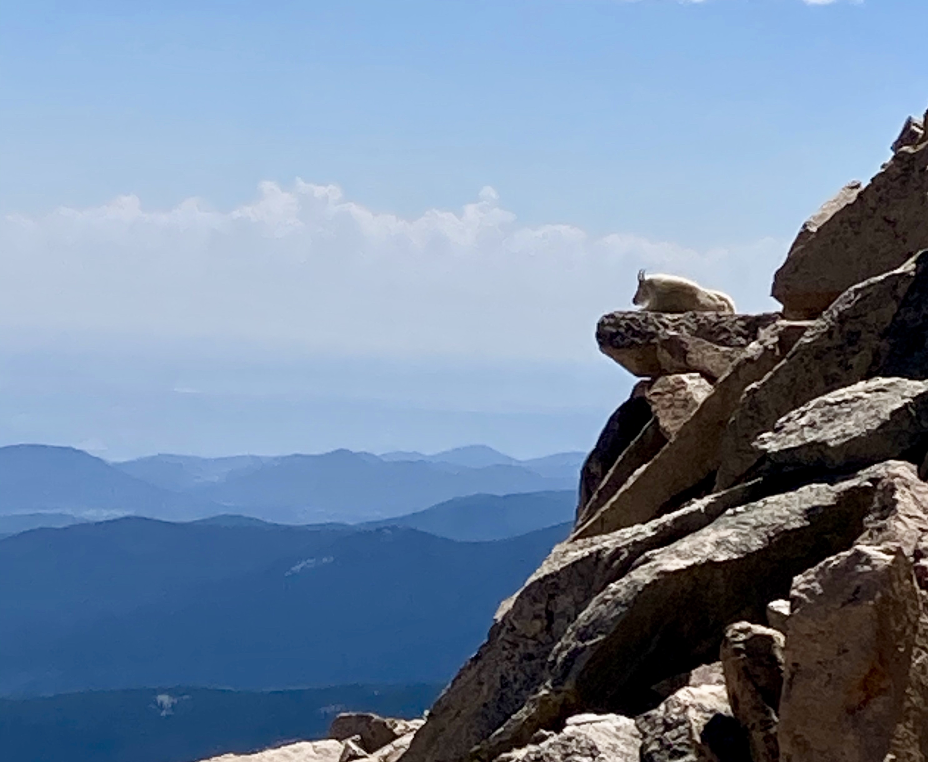
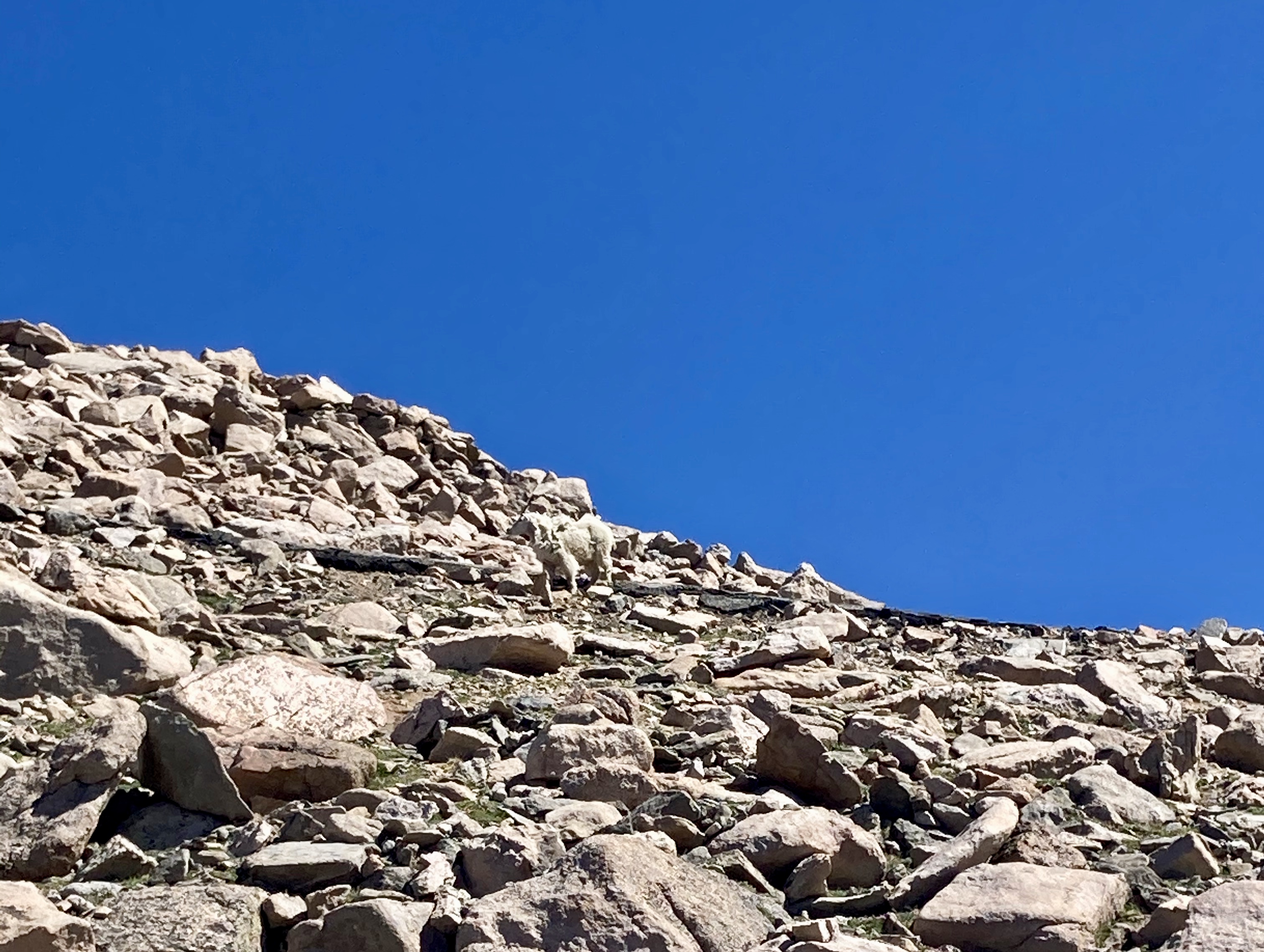
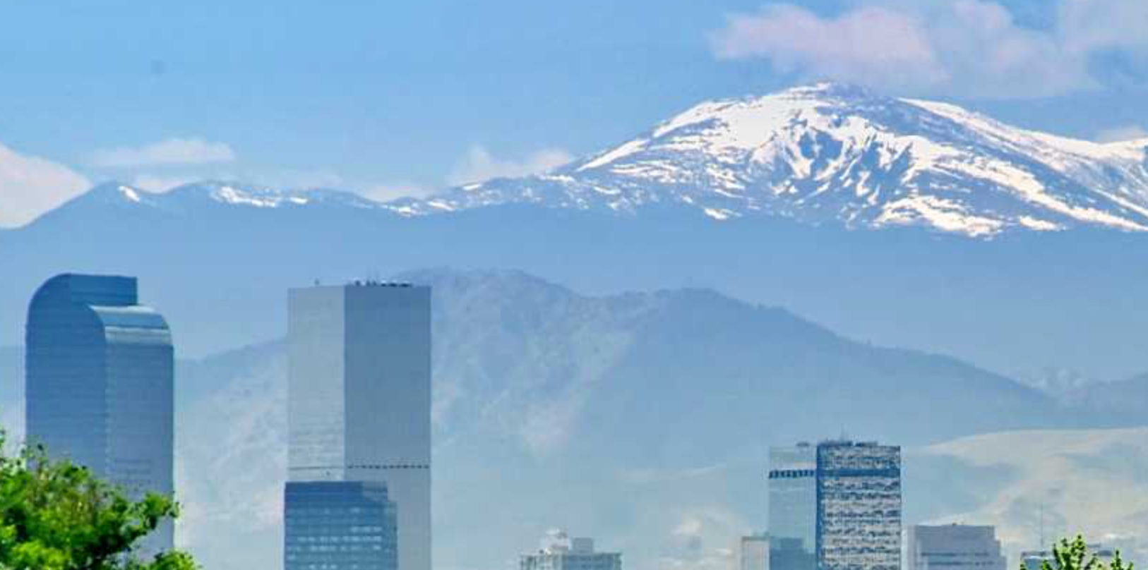
It is one of Colorado’s iconic 14ers. 14ers are peaks whose summits are at or above 14,000 feet above sea level. Colorado is home to 53 such peaks. Construction on Colorado Highway 5 began back in July of 1923. After about eight years of construction, the road opened to the public. The road is about 14 miles long and begins at an elevation of 10,600 feet at Echo Lake.  It winds through the Arapahoe National forest with trees 900 – 2,000 years old. Beautiful scenery of alpine lakes, the continental divide, wild flowers and wild life abound. 

Enough about the spectacular scenery, let’s get to the road conditions.  As the highest paved road in North America, there are some challenges that go along with maintaining the road.  Winters are long and harsh and take a toll on the road.  Let’s face it, at that elevation, most cyclists are pedaling along slowly enough to easily avoid the larger holes and cracks on the ascent.  And there are many cracks in the road, particularly from mile 9 to the summit.  There are also some wheel eating sized holes along the way.  

However, on the descent, these bumps, cracks, and holes present a danger to cyclists.  I’ve witnessed bike crashes resulting in broken bones on the descent.  The best advice I’ve received for the descent is to let some air out of the tires.  The next best thing to happen is not to have to contend with vehicles on the descent.  Without cars, cyclists can really take advantage of finding the smoothest line for the descent.  In many instances, this is right down the middle of the narrow road.

Perhaps the most exciting side effect of closing the road to motorized vehicles was the abundance of mountain goats and big horn sheep at the summit.  There were so many standing on the road, laying beside the road, playing just off the road. I wish that everyone could witness that, but I suspect the cars have a tendency to drive them further away.

It may be selfish, but I’m voting to keep the road closed to vehicles indefinitely.  Having the mountain to yourself on the bike was such a treat!  I saw all forms of bikes being ridden by riders of all ages.  One fine gentleman that I spoke with was on his second ascent of the day, and he was probably 20 years my senior.  I saw two kid trailers being pulled along by brave (and strong) parents.  What a memorable family outing that would be!

gCdxhpt+TpClequ0Jk4CDA

To the West of Mt. Evans

fullsizeoutput_528e

The Mountain Goat King

fullsizeoutput_529f

Can you see him?  And yes, the sky is really that blue in Colorado.

Roll Massif: Sunrise to Sunset Winter Park – a race review

Roll Massif: Sunrise to Sunset Winter Park – a race review

Roll Massif represents a collection of cycling events in Colorado.  They appear to have become the race/event director for several of the longer cycling events bike enthusiasts have come to know and love, as well as creating a couple of new events of their own.  One of those new events was the Sunrise to Sunset Winter Park Race on August 10, 2019.

Until this event, I had never done a twelve hour endurance event.  The idea of riding a bike for twelve hours was intimidating.  However, doing the race as a member of a team of up to five people would be something I could handle.  I invited a couple of colleagues to join me and Team Chocoholics was created!  We registered as a coed team of three.  I managed to get in one quasi pre-ride of the course a week before the race.  My training regimen consisted of sneaking in a handful of bike rides over the summer and, of course, consuming chocolate.

The night before race day, the team decided that I would take the first lap; I guess that was my reward for the crazy idea of racing.  I was reminded numerous times to have low expectations and that we were doing this for fun. It seems my teammates had training regimens similar to mine!   The race was held in the heart of Winter Park at Rendezvous Event Center.  We set up our tent and prepared to spend the day with our newest friends.

Each lap was about 9.5 miles long with ~1100 feet of elevation gain.  The first 3 miles were climbing, the next 2 miles were descending, the remaining 4 miles were rolling, but mostly flat and down.  The course was very well marked and volunteers marshaled at each road crossing, offering encouragement as you went by.  The course was fast & flowy singletrack sprinkled with some tree roots, puddles, and rocks.  It meandered from clearcut meadows through dense forrest.  We experienced sun, rain, lightening, and even some hail throughout the day.

Each member of team Chocoholics completed three laps, which was key to winning first place in the 3 person coed category.  Our total racing time was 11:34, just 45 minutes more than our second place competitor.  Interestingly enough, our lap times ranged from 1:08 to 1:29.  Considering that the three of us had never ridden together, our skill sets were very complementary to one another.

The race registration fee included a BBQ dinner at the Rendezvous Event Center, which was a fantastic way to end the day.  We were exhausted by the time the race was over and having a hot meal right at the race venue before awards was a bonus.  A band setup and played music during the last lap, which was also nice.  The Rendezvous Event Center has fully equipped bathrooms, which you may not appreciate until you experience a full portapottie in the afternoon of a hot summer day.

Overall, this was one of the better races I’ve participated in.  Congratulations to @RollMassif for putting on a top notch event on the first try!

fullsizeoutput_4db5


Life Lessons from the Sandpit

Life Lessons from the Sandpit

My first experience with riding through a substantial amount of sand occurred in a cyclocross race at Boulder Reservoir. After finishing that race, I told myself I would never race that course again.  I just don’t like riding a bicycle through sand.  When I started riding the dual sport motorcycle, we eventually made our way to substantial amounts of sand in the Utah desert.  After the Utah trip, I concluded that I just don’t like riding through sand at all, no matter what kind of bike I’m on.

Regardless of the type of bike you are on, the technique for getting through the sand is the same: sit down, weight the back wheel, allow the front wheel to float, and power through.  It sounds so easy, doesn’t it?  What could possibly go wrong?

As I applied the technique in the deepest part of the sand pit at a recent adventure in the fullsizeoutput_4d9dGreat Sand Dunes, I found that my front wheel tended to have a mind of its own and often went in the direction of its choice.  The words “bucking bronco” came to mind.    Of course I dropped the bike a number of times.  I was grateful for every recent squat repetition and push up.  Without those, I wouldn’t have had the strength to pick up a 300 pound bike repeatedly and keep going.

After making it through that 3/4 mile sand pit on my own, it occurred to me how many life lessons could be learned in that sand pit.

I have compiled a list of those lessons here to share with all of you:

~Keep pushing and eventually you get through it.

~Sometimes life requires that we do things we don’t like to do.

~Nurture your body and spirit so that it can overcome challenges.

~Don’t go on an adventure without first educating yourself of the risks.

~Learn skill techniques related to the activities you do.

~Be prepared for the worst case scenario.

Sometimes the bike doesn’t go through the sand in a straight line.  There will be bumps and bounces along the way.  There will be surprises along the way. You might even have to pick yourself up and dust yourself off from time to time.  You might need to relax your grip and just go with it.  Life is full of unexpected twists and turns. Be open and adaptable to a challenge.  Life really begins at the end of your comfort zone.

Life_begins_at_the_end_of_your_comfort_zone__Living_a_year_abroad_-_EazyCity_Blog


The Great Sand Dunes: Lessons in cornering, sand, and stream crossings

Recently, as Motoman and I watched the evening news, we learned that Medano Creek in Colorado’s Great Sand Dunes was running at record highs.  I looked at him and declared that we had to go see it for ourselves.  We’d taken our daughter to the Sand Dunes as a little girl and had such fond family memories.  With that, a vague plan was formed to ride dual sport motorcycles the following weekend to the Great Sand Dunes and camp on a mountain top.  My only stipulation to Motoman was that we spend only one long day on the backroads either going there or returning home, but not both.

We departed on the dual sport motorcycles Saturday morning heading south from Arvada to Sedalia, via the big concrete slab.  After turning west at Sedalia, it was a mix of dirt and gravel roads for the next 134 miles to Salida.  The open roads presented ample opportunity for practicing cornering at speed… or “speed” in my case.  Motoman is so fullsizeoutput_4d42
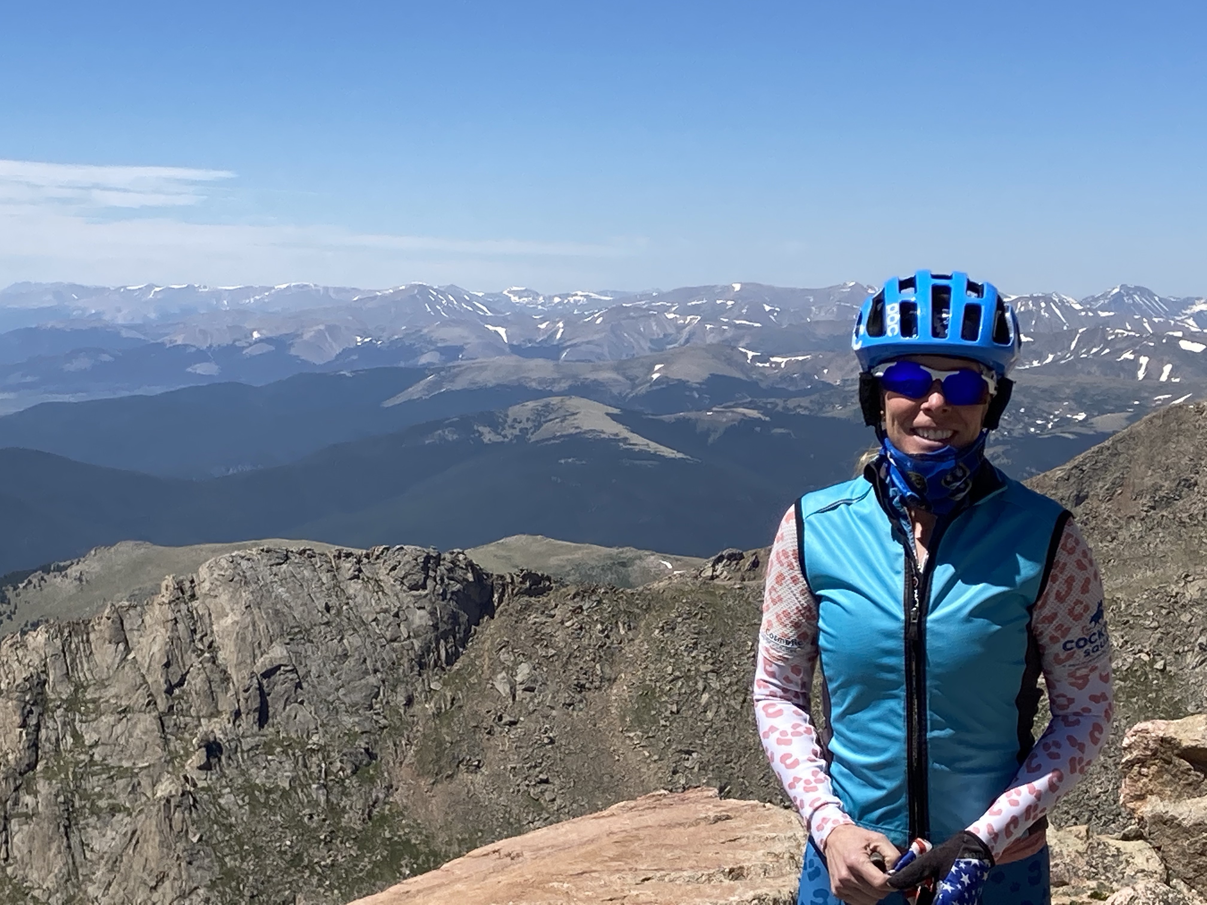
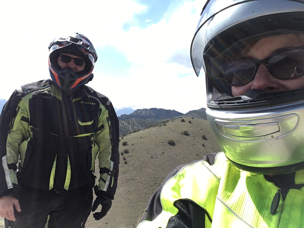
much faster than I will ever be on a motorcycle.  I’ll be forever grateful to him for riding in front of me to illustrate technique and for riding behind me to speak technique into my ears and guide me through corners via the Sena device broadcasting within my helmet.  There were enough miles and curves between here and Denver, that I believe the technique may have finally stuck.  My struggle with technique on the dual sport has been the simple fact that I ride so much.  I ride a road bicycle, a mountain bicycle, a cyclocross bicycle, a street motorcycle, and a dual sport motorcycle.  Each of these has a specific technique based on the terrain.  Using the wrong technique on the wrong bike on the wrong terrain can have disastrous results.  And truthfully, sometimes it’s hard to remember which technique to use because I forget which bike I’m on.

After all this fun cornering practice and dinner in Salida, we finally made our way to the Great Sand Dunes rather late in the day.  The original plan was to frolic in the creek and camp along Medano Creek Primitive road in the Preserve as we had done so many times years before.  This requires passing through a substantial sand pit to get there. In the past, we had done this in a 4WD vehicle.  On this trip, we would be passing through this sand pit on dual sport motorcycles.fullsizeoutput_4d45

Have I mentioned that I don’t like riding through sand?  It is second only to my dislike for riding through deep mud puddles.  I’m told that the technique to utilize when riding through deep sand on a dual sport motorcycle (or cyclocross bike) is to weight the back wheel and lighten the front wheel so that it sort of floats through the sand.  I found that by placing my body weight on the seat of my dual sport and pulling on the throttle led to a whole lot of nothing. I’m sure this technique works great for motorcycles with more aggressive tires than what I was using.  In order to move forward, I had to essentially ride my motorcycle like a stryder bicycle for kids  through deep sand.  I’m so proud to report that I made it through that sand pit and only dropped the bike a handful of times.  At least the landing was soft and I was able to pick the motorcycle up myself and carry on.

We soon found ourselves in the dark and at a place where we had to make the first of a series of deep stream crossing, or turn back and struggle through all that sand again.  As I sat on a log and waited for Motoman to return from scouting out the road ahead on the other side of the creek, a camper, AKA “Ranger Dude”, from a nearby campsite approached.  He informed me we could not camp where we had temporarily parked the motorcycles.  He went on to say he had seen 2 jeeps attempt the water crossing in front of us and turn back.  I honestly don’t know why he felt compelled to offer this unsolicited commentary.  I told him we were scouting out the situation and would not be camping there – especially if it meant we would be next to his unhelpful soul.

When Motoman returned,  we considered our options and agreed that continuing east on Medano Pass road and putting as much distance between us and Ranger Dude was our best option. It was dark. We were tired. We just wanted to set up camp and go to sleep. We’d lost count of how many water crossing there were, but our best guess is 10.  We made camp high on a mountain top, saw the spectacular milky way, and had an unrestful night’s sleep.

The next morning we awoke to birds chirping and not another soul in sight  As we continued east, we encountered maybe 5 additional water crossing that continued to get deeper and deeper. At each of the crossings, one or both of us would dismount and wade through the water to figure out the shallowest path through.  We were also checking for rocks or any debris that might create a hazard.  On the deepest of the crossings, we removed pannier bags from Motoman’s KTM and walked bikes through the water on the shallowest path.  Water was hip high on my small frame at its deepest.  Finally, the earth began to drop away as the descent began; the water was finally behind us.  Eventually, we made it to Colorado Highway 69, which is probably the smoothest stretch of road I have ever encountered.  It was smooth sailing until I ran out of gas a half mile from the Shell Station in Westcliffe.

Remember at the beginning of this story when I mentioned that the reason for this trip was due to the record high levels of Medano Creek in the Sand Dunes?  We’re still trying to figure out how two reasonably intelligent adults failed to consider that the ENTIRE creek would be running fast and high, not just the section in the Sand Dunes.  The road is now closed at the very first crossing due to high and fast water as the Spring thaw continues.

Click here to see our route via a relive video.

IMG_3684IMG_3681IMG_3678

Tour of the Moon – A Ride Review

Tour of the Moon – A Ride Review

I have ridden in a fair number of cycling events, such as the Triple Bypass, the Yellowstone Cycle Tour, and the Copper Triangle.  While each of these events has it’s own unique characteristics that have the potential to lure me back for a second ride, the only cycling event I’ve done twice is the Icon Tour of the Moon.  The ride starts and finishes in Grand Junction, Colorado each fall.

The ride organizers have conveniently created two registration options for riders.  The first option is the Classic Loop from Grand Junction through the Colorado National Monument and back to Grand Junction for a total of 41 miles.  The other option consists of the Classic Loop plus an additional ~20 miles through the farmlands around Fruita and then returning to Grand Junction. The result is a metric century ride or 62 miles.  When my friend was asking which option we should register for, I described it as the pretty part that you’re paying for vs. the afterthought.

What I mean by that is one lane of Rim Rock Drive (the main road through the Colorado National Monument) is closed to non-ride event traffic during the ride.  This means that you only have to lookout for oncoming vehicles, and most of those are SAG vehicles or motos anyway.  This makes for a fantastic way to experience such a majestic place!  In exchange for your quiet riding pleasure, all that is required is lights on your bicycle.  Folks, it just doesn’t get any better than this!  After exiting the Colorado National Monument, you have the option to return immediately to Grand Junction or take the tour around Fruita.  While the country roads offer their own charm and views of the Grand Mesa Book Cliffs, the scenery in the Colorado National Monument is hard to beat.  The race organizers have created a segment of road called the “King/Queen of the Flats” to add some excitement to the metric century portion of the ride.

All ride entry fees include a jersey and post-ride lunch.  The lunch is typically salad, pasta, and desert.  The aid stations throughout the ride are very well stocked with fluids, bagels, cookies, fruit, trail mix, and energy bars.  The volunteers are friendly and helpful.  Law enforcement is attentive.  Overall, if the weather cooperates, this ride is a wonderful way to cap the cycling season.

20180929_101630

The Ride When I learned a Skill After I Needed it

Riding from our house in Arvada, Colorado to the Rampart Range located in the Pike-San Isabel Forest just southwest of Castle Rock was one of longest distances I’ve ridden on my little Yamaha XT-250, AKA Dory.   The round trip (including the trails we rode) was approximately 120 miles.  After some discussion, Motoman and I decided to ride there because of the diversity of trails in the system and unlikelihood for mud.  It had snowed a couple of days before and we were hopeful that it would not be muddy.   It turns out that the OHV trails at Rampart Range are very similar to the mountain bike trails at Buffalo Creek in that they are covered with granite pebbles and sand, which tends to keep the mud to a minimum.

When we arrived at the Rampart Range Staging parking lot, I was surprised at how many vehicles were in the lot.  I became nervous about how many other riders I would encounter along a trail and how I would maneuver my motorcycle to share the trail.  Mountain bikes are so much lighter!  When Motoman asked me which trail I wanted to ride first, I picked a beginner trail, of course!  It was a twisty path through the forest with the occasional water puddle.  The trail was fairly smooth and the most common obstacle was tree roots, which are slippery when wet. It was an uneventful ride until we came to a 40 foot section of rocks on a downhill where I completely lost control of the motorcycle.  I had stood up for the descent and when I reached for the rear brake with my right toes, all I got was air.  I bounced down the trail, afraid to touch the front break for fear I’d go over the bars.  I had a death grip on the clutch and bars.  By the time I thought to release the clutch to slow down, I was at the bottom of the hill and came to an easy stop.  I don’t know how I didn’t crash.  We encountered only two other riders on this trail, despite that full parking lot.

The trail ended and we found ourselves on the Rampart Range dirt road, which travels through the heart of the trail system.  It was here that Motoman taught me the rear brake  skid technique.  It works like this: get your speed up to about 15 MPH, pull in the clutch, let off the throttle, and step on the rear brake hard enough to skid.  We practiced this over and over, eventually seeing who could leave the longest skid mark on the dirt road. I wish we’d had this session before that first trail!! [Sidebar: now I understand why Motoman is constantly buying new tires.]

The next trail we did was still relatively smooth, but much muddier and hence slipperier.  The climbs and the descents were also steeper.  We found a beautiful rock formation and stopped for a snack and pictures.  On this trail, we encountered only two other riders.

It seems every time I ride the motorcycle, I learn something new.  This ride offered three valuable lessons. First, the skidding lesson has already proven to be a valuable addition to the toolbox.  I used it non-stop for the second trail we rode that day.  Second, I don’t like riding in mud.  Third, speed is helpful.  If I’d applied the brakes during the rocky section in the first trail, I suspect I would have gone so much slower that I would have crashed.  The fact that I took that section at speed kept me from getting a wheel hung up on a rock.  I’ve replayed that section in my mind a number of times since the ride itself, and words from my fearless daughter keep coming to mind:

“Sometimes you just gotta give it gas and hang on.”

45763045-0159-4908-9A75-22A162644A51